National Oceanic and Atmospheric Administration Fisheries
Upper Barataria Marsh Ecological Monitoring
An activity of the NOAA DARRP Cooperative Agreement
ongoing
The Challenge
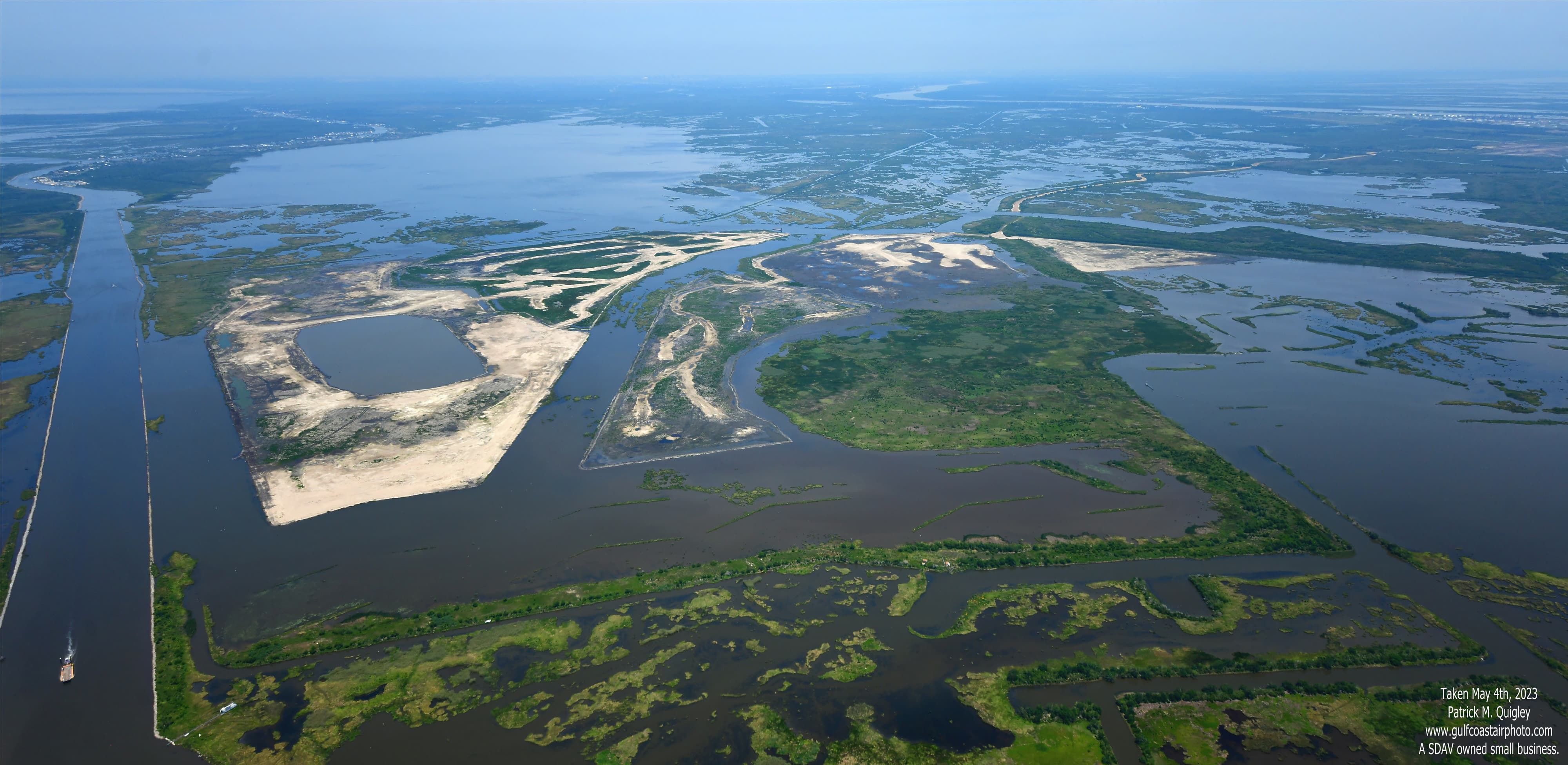
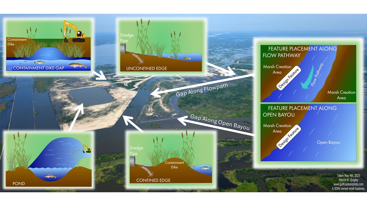
The Upper Barataria Marsh Creation Project is a 1,200-acre restoration initiative in Louisiana's Barataria Basin designed to restore wetland, coastal, and nearshore habitats that were injured by the Deepwater Horizon oil spill of 2010. This project stands out through its nekton-focused design. Unlike typical marsh creation projects that prioritize only land building, NOAA engineered this project to benefit aquatic organisms. The design includes strategic pond placement, engineered flow pathways, unconfined marsh edges, intentional dike gaps, and lower overall elevation profiles. These elements optimize habitat functionality for fish and other aquatic species rather than simply creating land mass.
The Approach
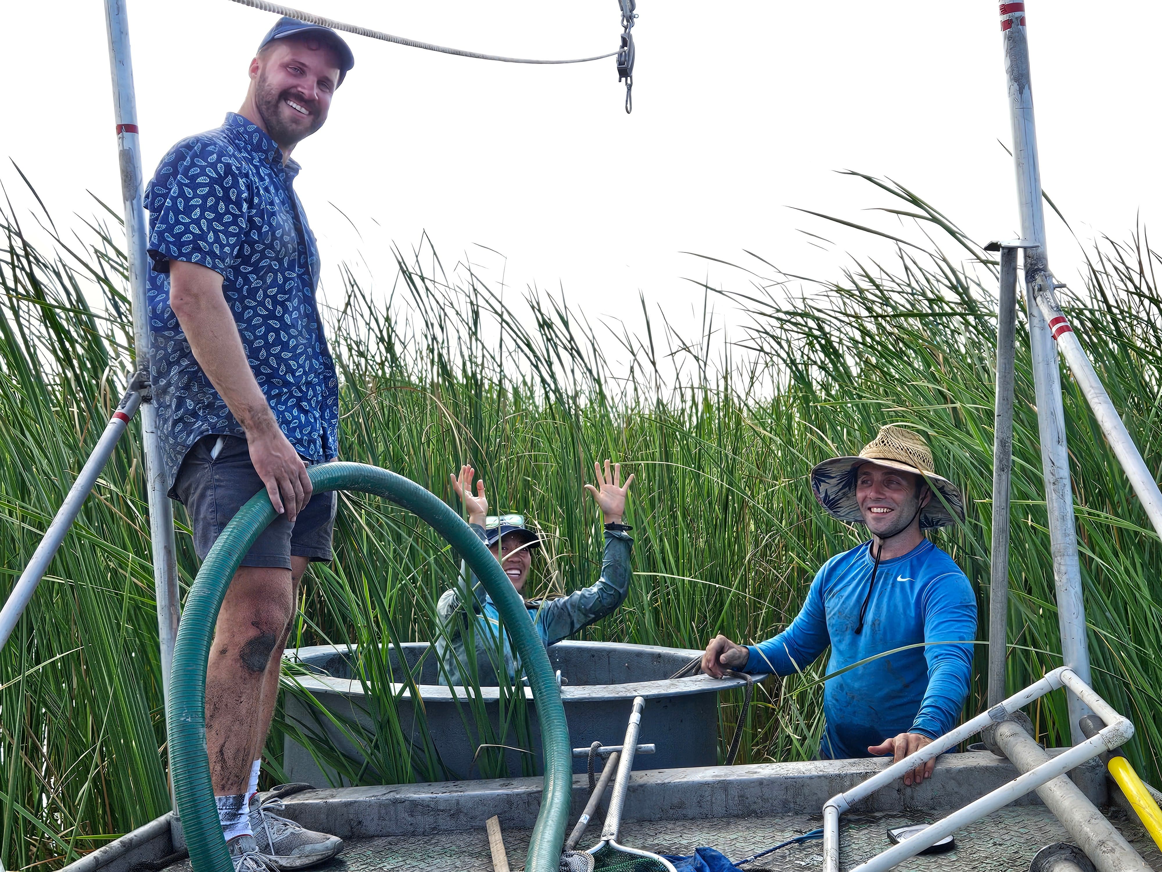
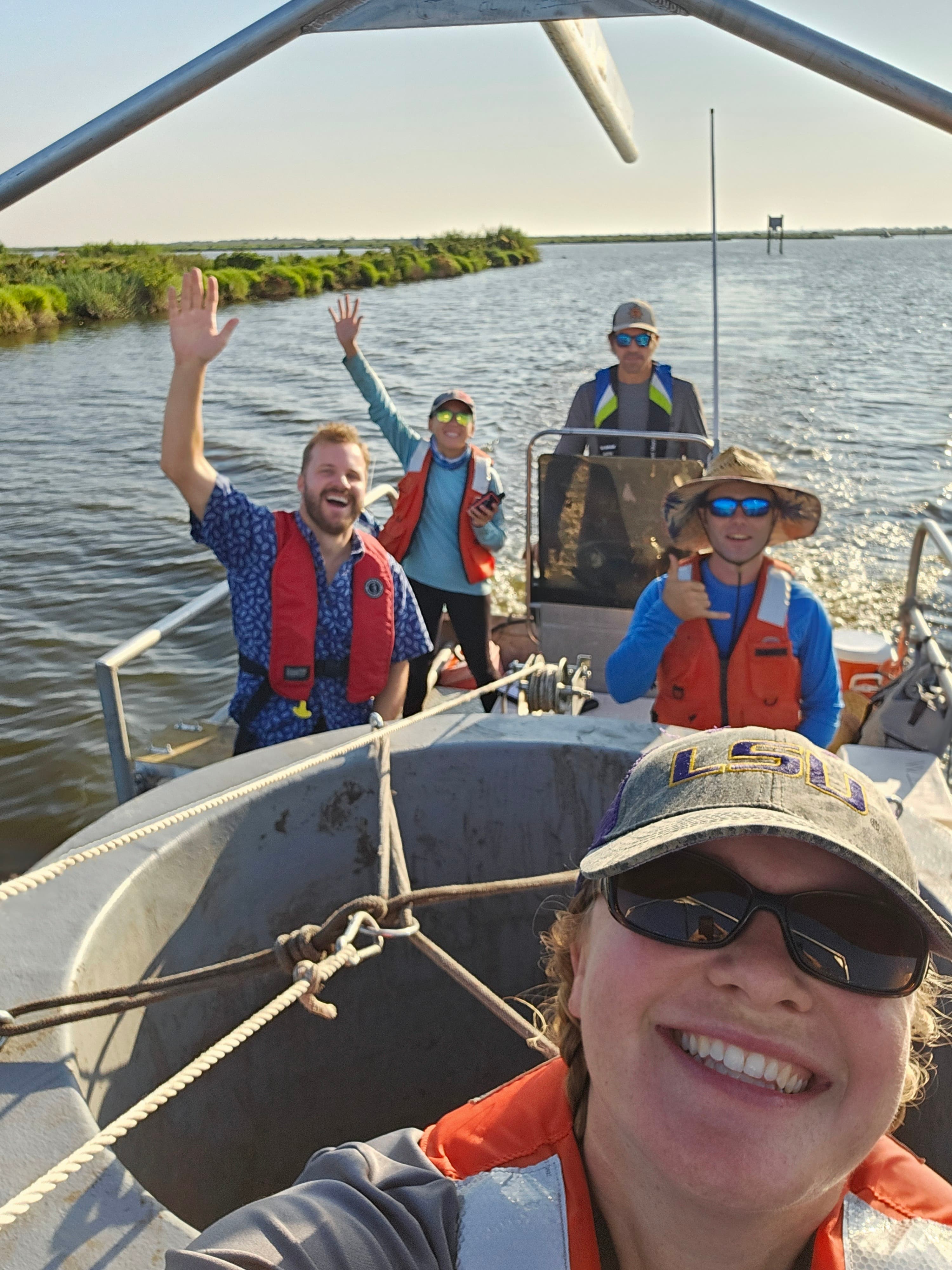
The Upper Barataria Marsh Creation Project was completed in 2023, and monitoring activities are now underway. Ecological monitoring and adaptive management (MAM) of the project will be conducted by a growing MAM team composed of partners from The Water Institute, NOAA, USGS, CPRA, LSU, Nicholls State University, and more. The team is employing an array of techniques—from field sampling and physical data collection to remote sensing and numerical ecology analyses to track critical indicators like soil characteristics, plant communities, water quality, and wildlife populations. We're particularly excited about NOAA’s innovative learning goals for this project, such as understanding how hydrologic connectivity and different marsh edge types contribute to ecosystem services, which will be used to design and build better marsh creation projects.
The monitoring program is unprecedented in scope and duration. While standard restoration projects typically monitor basic metrics like elevation and vegetation for about 5 years, NOAA has committed to a comprehensive 20-year monitoring program. This extended monitoring will track fish population dynamics, vegetation establishment, elevation changes, soil development, and habitat fragmentation metrics. This extensive monitoring approach reflects NOAA's commitment to understanding restoration effectiveness and advancing coastal ecosystem recovery science.
For additional project details and monitoring data, please see NOAA’s project page.
Project successes to date include:
- Collaboration between The Water Institute and NOAA to hone a revised comprehensive Monitoring and Adaptive Management (MAM) strategy to ensure the project provides long-term benefits to the area
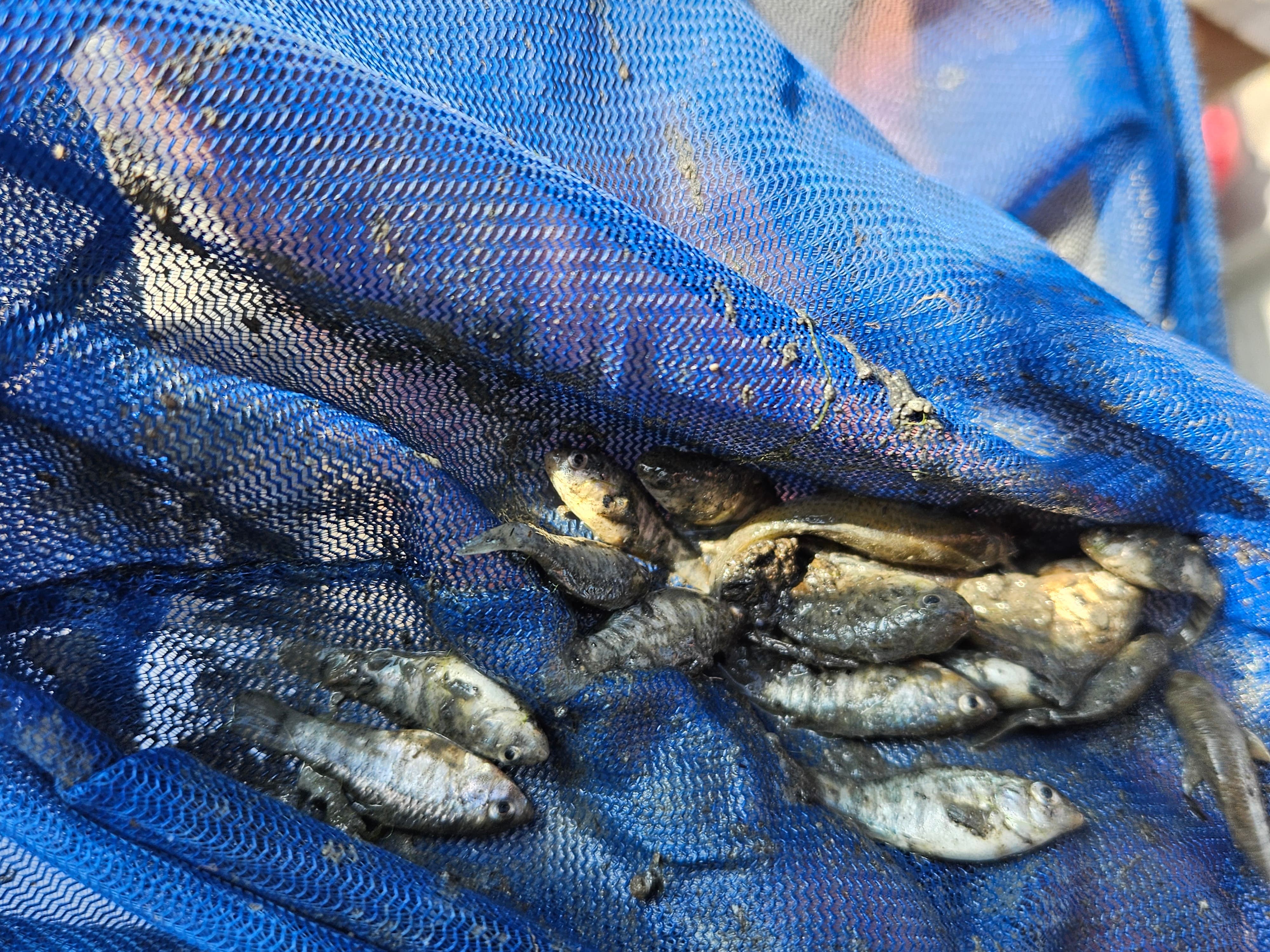
- Increased capacity at a Gulf scale for conducting fixed-area sampling of aquatic fish and macroinvertebrates by constructing a new drop sampler to facilitate local data collection in Louisiana
- Successfully implemented nekton monitoring in 2024 using fixed-area gear types (drop samplers, throw traps) in the project area
- Ongoing work with project collaborators to develop the first synthesis report
In Partnership With
KEY TEAM MEMBERS