National Oceanic and Atmospheric Administration Fisheries
Lower Trophic Level Monitoring for Barataria Basin
An activity of the NOAA DARRP Cooperative Agreement
The Challenge
Lower trophic level (LTL) organisms represent the base of the food web. In Louisiana’s estuaries these can consist of:
- wetland vegetation,
- phytoplankton and zooplankton in the water column,
- microscopic algae that live on the sediment surface,
- and small invertebrates like worms and clams that burrow under the sediment.
The presence of these organisms can indicate changes in ecosystem health, such as changes in salinity or anoxia events, and can be used to predict changes in the distribution of larger fish and shrimp species. They are also a critical food source for juvenile fish that utilize the estuary as a nursery habitat. However, large knowledge gaps necessitate collection of new data to establish relevant ecological baselines with which we can measure future ecological changes in our coastal ecosystems.
The Lower Trophic Level Monitoring Project for Barataria Basin is an ecosystem-wide monitoring effort developed to set ecological baselines to support restoration planning in response to the 2010 Deepwater Horizon oil spill. The first phase of this multi-part effort investigated data gaps in existing LTL information relevant to the Barataria Basin and engaged natural resource management stakeholders to identify how LTL information could inform management of coastal resources. Next, an initial plan was established to collect new data to fill the identified gaps and meet the identified management needs. The initial plan was then further refined and an implementation plan developed. Efforts to implement the monitoring plan will be underway between 2025 and 2028 after which the data will be synthesized and key findings reported. The outcomes of this work will improve our understanding of the base of the Barataria Basin food web and strengthen existing ecosystem models that provide a baseline for restoration planning.
The Approach
The Lower Trophic Level Monitoring Project is unprecedented both in its spatial and temporal scales as well as in the breadth of organisms all examined in parallel. The Water Institute serves a critical role as the collaboration hub for implementation of the Lower Trophic Level Monitoring Project. The Water Institute has partnered with NOAA, USGS, LSU, ULL, UC Santa Cruz, and Dynamic Solutions, LLC, in implementing this multi-phase project.
Current activities involve a basin-wide monitoring approach to collect data on
- the biomass, abundance, and community structure of key LTL groups (phytoplankton, microphytobenthos, zooplankton, and macroinfauna), as well as
- key environmental drivers such as water quality and vegetation.
An array of techniques – from field sampling to desktop remote sensing – are being employed in this effort.
This extensive monitoring approach reflects NOAA's commitment to understanding restoration effectiveness and advancing coastal ecosystem recovery science. For additional project details and monitoring data, please see NOAA’s project page here.
Project successes to date include
- Compilation of existing LTL data relevant to Barataria Basin with a data gap analysis and the identification of natural resource management needs for LTL information. Relevant publication currently under peer review.
- Development of a monitoring and adaptive management (MAM) activity implementation plan (MAIP) for consideration by the Louisiana Trustee Implementation Group.
- Refinement of the monitoring strategy and development of an Implementation Plan, including detailed sampling and analysis protocol and sampling design.
- Completion of the LTL Year 1 (2025) monitoring across Barataraia Basin in collaboration with a suite of project partners across numerous institutions. During Year 1, the monitoring teams spent a total of 60 days in the field across 4 seasonal sampling events and 12 monthly sampling events. The field teams collected over 3,100 samples across various LTL groups and data types.
- Continued refinement of the monitoring strategy and updates to the Implementation Plan based on lessons learned in Year 1, including detailed sampling and analysis protocol and sampling design.
- Ongoing implementation of LTL monitoring Year 2 (2026) across Barataria basin in collaboration with a suite of project partners across numerous institutions. Additional data collection to occur in Year 2 includes seasonal stable isotope sample collection. Data collection is expected to occur continuously between 2025 and 2028.
Activity Photos
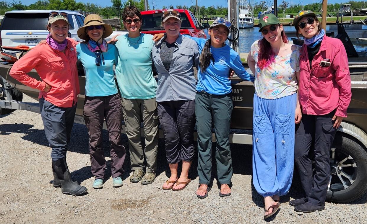
Figure 1. Field team for the Spring 2025 field campaign. Photo credit: The Water Institute.
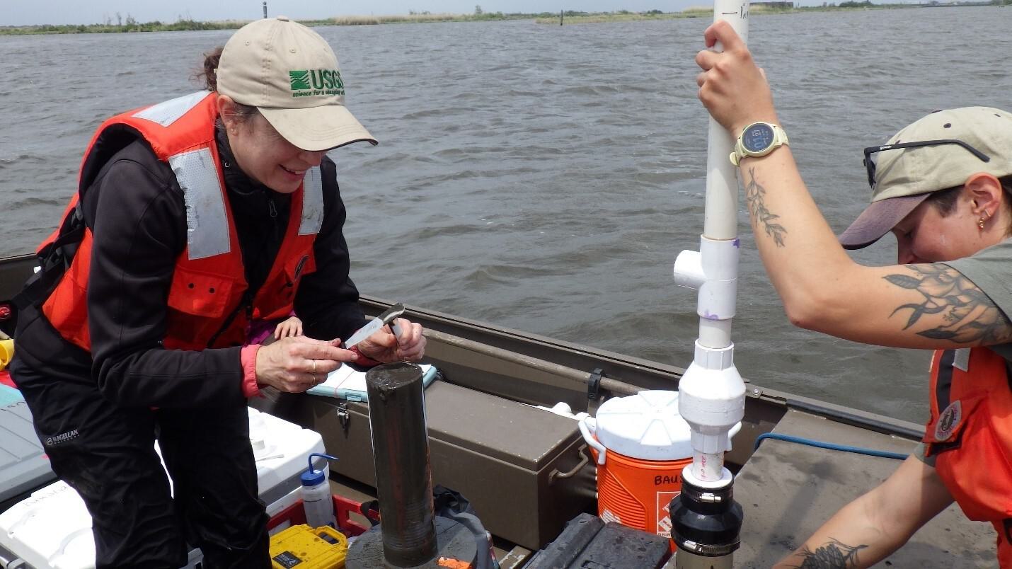
Figure 2. Melissa Baustian and Brenae Bergeron of USGS using a long-handle piston core to sample microphytobenthos in open water. Photo credit: The Water Institute.
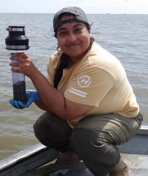
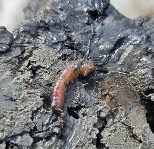
Figure 3. Top: LSU PhD student (Kohinur Akter) using a long-handle piston core to sample macroinfauna in open water. Bottom: Polychaete worm observed emerging from a sediment burrow. Photo credit: The Water Institute.
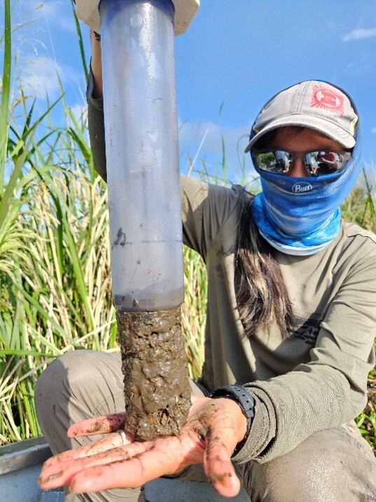
Figure 4. Emelia Marshall extruding a sediment core. Photo credit: The Water Institute.
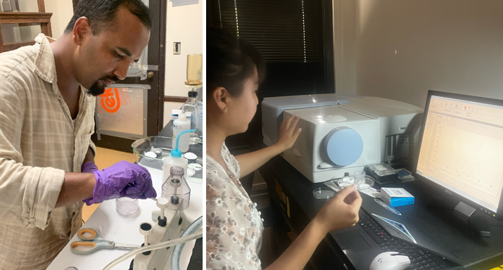
Figure 5. Remote sensing sample and data processing by Nirmal Raila (left) and Bingqing Liu (right) at ULL. Photo credit: Bingqing Liu, ULL.
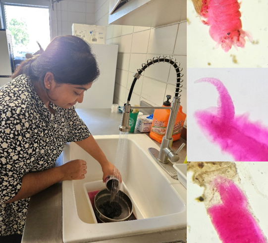
Figure 6. Kohinur Akter at LSU processing macroinfauna samples. Snapshots of polychaete taxa observed from samples. Photo credit: Erin Kiskaddon, The Water Institute.
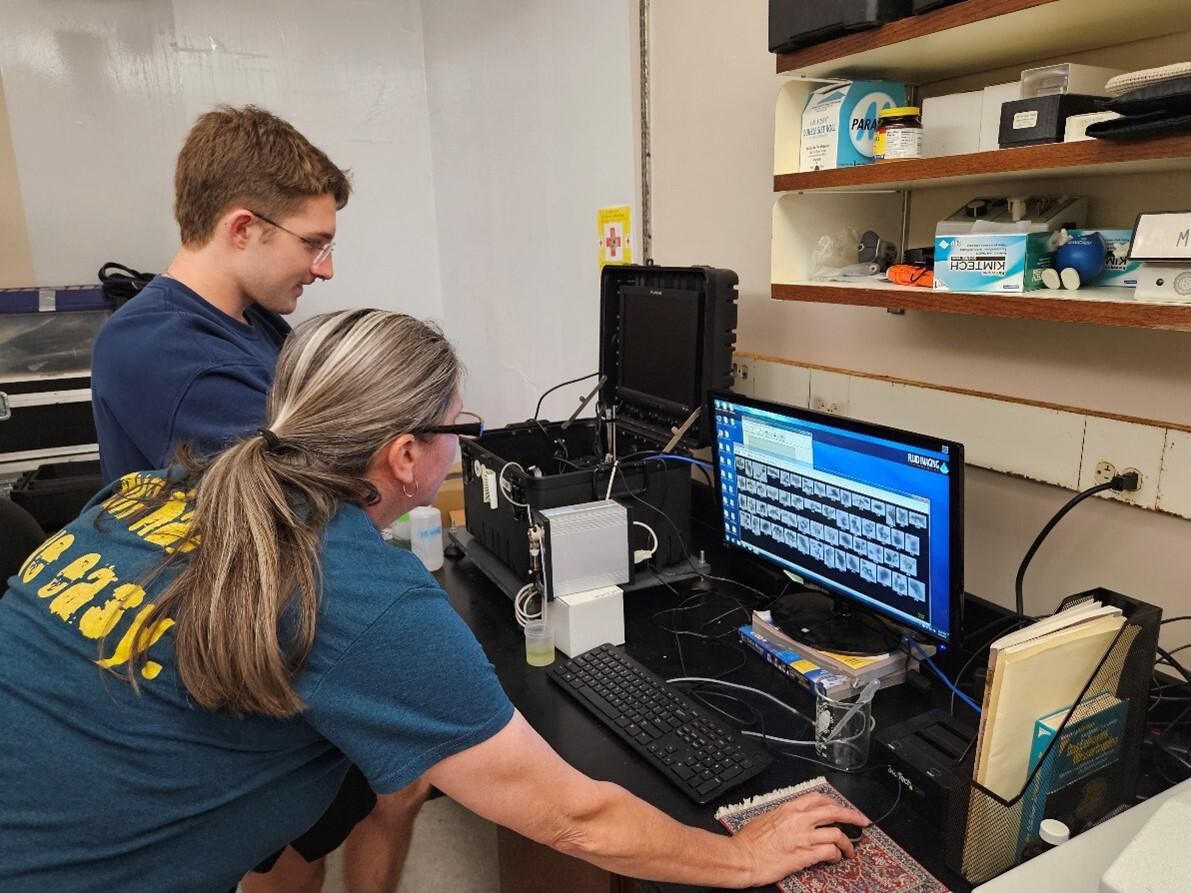
Figure 7. Malinda Sutor at LSU analyzing zooplankton samples. Photo credit: Erin Kiskaddon, The Water Institute.
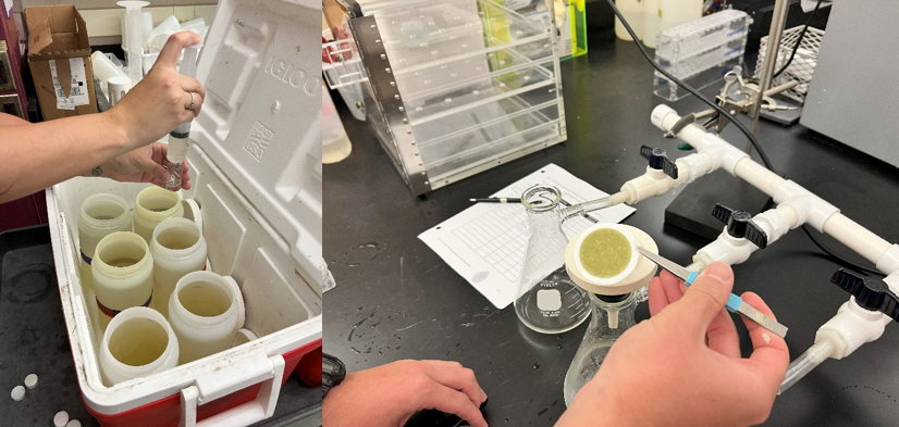
Figure 8. Phytoplankton sample processing by Sibel Bargu and Monique Boudreaux at LSU. Photo credit: Monique Boudreaux, LSU.
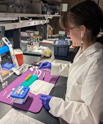
Figure 9. Microphytobenthos sample processing by Emily Lain at USGS. Photo credit: Melissa Baustian, USGS.
In partnership with

KEY TEAM MEMBERS