The Water Institute at AGU25
The Water Institute serves at the intersection of science, collaboration, and impact. At AGU 2025, we’re proud to share the transdisciplinary work shaped alongside communities, industry, agencies, and academic partners — because resilience is built together.
See The Water Institute's daily schedule of sessions, presentations and collaborative work on display this week at AGU25!
Sessions, Talks and Panels at AGU25
AGU25 Day 1 - Monday, December 15
H11Q-1099The Anatomy of a Hydrologic Extreme
8:30 A.M., Mark Bartlett, Data Science and Machine Learning Practice Lead at The Water Institute
Understanding and predicting hydrologic extremes—particularly those of runoff and streamflow—is fundamental for flood risk assessment and the calibration of predictive flood forecast models. Traditionally, such extremes are inferred from observed hydrographs and rainfall records obtained from gages. In ungaged regions, streamflow extremes are typically estimated from rainfall extremes using computational models that simulate hydrologic processes. This traditional modeling approach reveals a critical gap: the absence of analytical linkages between rainfall and streamflow statistics that explicitly account for the nonlinear, threshold-driven processes governing streamflow—namely, evapotranspiration, baseflow recession, and soil moisture dynamics.
NH11D-0390 Living Models for Reliable Real-Time Flood Situational Awareness
8:30 A.M., Pranavesh Panakkal, Research Scientist - Flood Risk and Muthukumar Narayanaswamy, Director of Coastal and Compound Flood Risk at The Water Institute
Understanding and predicting hydrologic extremes—particularly those of runoff and streamflow—is fundamental for flood risk assessment and the calibration of predictive flood forecast models. Here, we examine the anatomy of runoff and streamflow extremes by developing a parsimonious analytical framework that unifies semi-distributed hydrologic modeling, the SCS Curve Number method, and stochastic ecohydrology—specifically the probabilistic description of soil moisture dynamics.
EP13C-1506 Using Field-derived Elevation Milestones to Inform Synthetic, Historic DEMs for Tidal Marsh Retrospective Modeling Efforts
2:15 P.M., Christopher Esposito, Research Geoscientist at The Water Institute
Understanding and predicting hydrologic extremes—particularly those of runoff and streamflow—is fundamental for flood risk assessment and the calibration of predictive flood forecast models. Here, we examine the anatomy of runoff and streamflow extremes by developing a parsimonious analytical framework that unifies semi-distributed hydrologic modeling, the SCS Curve Number method, and stochastic ecohydrology—specifically the probabilistic description of soil moisture dynamics.
EP13C-1505 Using Remotely Sensed Inundation to Map Elevation in Low Gradient Coastal Landscapes
2:15 P.M., Christopher Esposito, Research Geoscientist; Maricel Beltran Burgos, Geoscientist at The Water Institute
Understanding and predicting hydrologic extremes—particularly those of runoff and streamflow—is fundamental for flood risk assessment and the calibration of predictive flood forecast models. Here, we examine the anatomy of runoff and streamflow extremes by developing a parsimonious analytical framework that unifies semi-distributed hydrologic modeling, the SCS Curve Number method, and stochastic ecohydrology—specifically the probabilistic description of soil moisture dynamics.
H14G-05 Compound Flood Hazard Modeling: A Comparative Study of CPU-Based and GPU-Accelerated Hydrodynamic Models for Emergency Response
4:55 P.M., Arslaan Khalid, Research Scientist; Pranavesh Panakkal, Research Scientist - Flood Risk; Muthukumar Narayanaswamy, Director of Coastal and Compound Flood Risk at The Water Institute
Understanding and predicting hydrologic extremes—particularly those of runoff and streamflow—is fundamental for flood risk assessment and the calibration of predictive flood forecast models. Here, we examine the anatomy of runoff and streamflow extremes by developing a parsimonious analytical framework that unifies semi-distributed hydrologic modeling, the SCS Curve Number method, and stochastic ecohydrology—specifically the probabilistic description of soil moisture dynamics.
AGU25 Day 2 - Tuesday, December 16
SE21A - From Watersheds to Planetary Boundaries: Rethinking Water Governance Through Nexus Frameworks and Safe Operating Spaces
8:00 A.M. Invited panelist Alyssa Dausman, Chief Scientist at The Water Institute
As water systems face intensifying pressures from climate change, land use, and socio-economic demands, governance approaches must evolve to integrate complexity, cross-scale dynamics, and planetary limits. This panel explores how frameworks like the Planetary Boundaries and Nexus approaches [e.g., Water-Energy-Food-(Ecosystems) and/or explicitly including Health dimensions of the natural and human communities] can move beyond traditional models like IWRM and support actionable, multiscale water governance.
EP21D River Deltas: Observing, Modeling, and Predicting Natural and Anthropogenic Changes I Poster
8:30 A.M. Christopher Esposito, Research Geoscientist at The Water Institute
River deltas are among the most valuable ecosystems on Earth, providing coastal protection against storm impacts and sequestering carbon. However, these coastal systems are threatened by climate change, land loss, and anthropogenic activities, with long-term sustainability dependent on sediment delivery, biogeochemical cycles, and human interventions. In this session, we encourage the presentation of research that fills knowledge gaps such as carbon budgets, water and sediment residence time, impacts of extreme events, upscaling.
SY22A-08 Evaluation of Emission Reduction and other Societal and Environmental Outcomes: Structured Decision Making for the Louisiana Climate Action Plan
11:45 A.M. Alyssa Dausman, Chief Scientist at The Water Institute. Also listed: Erin Kiskaddon, Allison DeJong, Colleen McHugh, Abby Littman, Soupy Dalyander
Climate action planning continues to accelerate rapidly across the globe as communities seek to prepare to thrive in an uncertain future. Within the last decade, research efforts have begun to evaluate approaches used to develop city, state, and national-level climate action plans, finding that planning efforts are often as diverse as the localities they represent. In this study, we evaluate the strengths and limitations of integrating qualitative and quantitative climate action evaluation methodologies in a planning process grounded in structured decision making using Louisiana as a case study.
EP23B River Deltas: Observing, Modeling, and Predicting Natural and Anthropogenic Changes II Oral
2:15 P.M. Christopher Esposito, Research Geoscientist at The Water Institute
River deltas are among the most valuable ecosystems on Earth, providing coastal protection against storm impacts and sequestering carbon. However, these coastal systems are threatened by climate change, land loss, and anthropogenic activities, with long-term sustainability dependent on sediment delivery, biogeochemical cycles, and human interventions. In this session, we encourage the presentation of research that fills knowledge gaps such as carbon budgets, water and sediment residence time, impacts of extreme events, upscaling.
EP24B River Deltas: Observing, Modeling, and Predicting Natural and Anthropogenic Changes III Oral
4:15 P.M. Christopher Esposito, Research Geoscientist at The Water Institute
River deltas are among the most valuable ecosystems on Earth, providing coastal protection against storm impacts and sequestering carbon. However, these coastal systems are threatened by climate change, land loss, and anthropogenic activities, with long-term sustainability dependent on sediment delivery, biogeochemical cycles, and human interventions. In this session, we encourage the presentation of research that fills knowledge gaps such as carbon budgets, water and sediment residence time, impacts of extreme events, upscaling.
AGU25 Day 3 - Wednesday, December 17
SE31B Navigating the Crosswinds for Collaboratory Wins
8:00 A.M. Invited Panelist Alyssa Dausman, Chief Scientist at The Water Institute
There is wind in the sails of collaborative science, allowing us to go further AND faster than one could alone. Oral and poster sessions on collaboratory science at AGU24 highlighted several case studies across U.S. watersheds, with respect to WHAT can be gained by collaborations and HOW to work most effectively across disciplines. Collaboratories are growing, breaking down barriers, broadening the direction of research, leading to new and novel insights, and accelerating the pace of discovery and implementation.
EP31G-1735 Cliff Erosion Observations and Modelling at the Wierum Salt Marsh in the Dutch Wadden Sea: The Importance of Local Water Levels and Site-Specific Calibration
8:30 A.M. Ioannis Georgiou, Director of Coastal and Deltaic Systems at The Water Institute
Salt marshes play a vital role in coastal resilience, offering ecosystem services such as carbon sequestration, biodiversity, wave attenuation, and shoreline stabilisation. In low-lying regions like the Netherlands, their function as nature-based flood defences is increasingly significant under conditions of accelerating sea-level rise and increasing storm intensity. The long-term effectiveness of this role depends on maintaining stable marshes. Although prior studies have established a linear correlation between wave power and cliff retreat rate, models based on this relationship are often unverified for capturing annual and spatial variability, both of which are essential for effective coastal management. This study integrates a sub-grid cliff erosion module (Bendoni et al., 2019) into a 2D depth-averaged hydrodynamic framework.
NH32A-01 Advanced Methods to Evaluate Compound Flood Risk and Forecast Flooding in Real-Time for the City of Jacksonville
10:30 A.M. Brett McMann, Client Relationship Manager at The Water Institute
Compound flooding—the combination of fluvial (riverine), pluvial (urban) and coastal flood hazards—poses a significant risk to communities across the State of Florida. Traditionally, coastal and inland flood hazards have been quantified separately, either with event-based approaches or probabilistic methods. These approaches may underestimate the extent and frequency of flooding, however, because they do not account for compound flood effects. In response to this challenge, a team led by The Water Institute has developed a scalable, automated compound flood simulation system for the City of Jacksonville. This presentation will provide an overview of compound flood model development and FloodID deployment for the City of Jacksonville, including initial modeling results representing present day and plausible future conditions.
Science in Action: Advancing Climate Resilience and Environmental Justice through Local and State Policy Engagement
2:00 P.M. Jessica Henkel, Director of RESTORE Act Center of Excellence for Louisiana
As climate-driven extreme weather events, from historic flooding to prolonged heatwaves, grow in frequency and severity, communities across the country are grappling with compounding challenges. This session will explore how scientists can meaningfully engage with both policymakers and communities to co-develop solutions that advance climate resilience and environmental justice. Panelists will share examples of successful engagement on issues such as flood risk, urban heat islands, and the relocation of climate-displaced populations.
H33S-1568 Using Algal Pigment Field Data to Validate Remote Sensing and Initialize Numerical Modeling for Prediction of Future Harmful Algal Blooms
2:15 P.M. Ioannis Georgiou (co-author), Director of Coastal and Deltaic Systems
Aquatic ecosystems are undergoing changes due to shifts in climatic conditions (e.g., heavy rainfall events, warmer temperatures) that influence nutrient loading that often leads to increased growth rates of phytoplankton, including those that can be harmful. The increased frequency of harmful algal blooms is problematic because they can impact wildlife, fisheries, and humans, decrease property values, and lead to bottom-water hypoxia. Integrating field observations of algal pigments, including chlorophyll a and accessory pigments, with remote sensing technology and numerical modeling can provide innovative tools that learn from the past to predict future temporal and spatial variation of CyanoHABs.
SE34A Grassroots Knowledge and Coastal Stewardship in Cameron Parish: Lessons for Sustainable Fisheries
4:15 P.M. Shawn Doyle, Coastal Ecologist at The Water Institute
Fishing, both freshwater and saltwater, is not only a major economic engine for the state of Louisiana, but a way of life. In coastal communities like Cameron Parish, fishing traditions span generations, with families who have spent lifetimes learning about the ecosystem and playing key roles in conserving it. The panel discussion will emphasize grassroots knowledge from real-life experience of community members and its value for the scientific community to monitor ecosystems and understand changing environmental conditions.
H34I Water and Society: Leveraging Digital Twins, AI, and Other Emerging Technologies to Support Management and Governance of Coupled Human-Water Systems I Oral
4:15 P.M. Alyssa Dausman, Chief Scientist. Jessica Henkel, Director of Research Operations
This session explores the transformative potential of emerging technologies, including digital twins, AI/ML, AI/DL, and real-time data processing, in reshaping water management and governance. The integration of advanced modeling techniques with understanding of human behavior, governance dynamics, and multi-sector resilience is crucial for effective decision-making in complex, coupled human-water systems.
H34I-04 Supporting Ethical Decision Making when utilizing Artificial Intelligence and Machine Learning in Product Development for Water Management
4:45 P.M. Beaux Jones, CEO and President at The Water Institute
At The Water Institute, we believe that the technologies, tools, and insights developed through transdisciplinary and interdisciplinary applied research to support water management have the potential to create meaningful, lasting impacts in the world to support communities in being less vulnerable and more resilient. However, the approach to technology transfer must be guided by a deep commitment to scientific integrity, public benefit, and ethical stewardship.
AGU25 Day 4 - Thursday, December 18
H41V - Water and Society: Leveraging Digital Twins, AI, and Other Emerging Technologies to Support Management and Governance of Coupled Human-Water Systems II Poster
8:30 A.M. Alyssa Dausman, Vice President and Chief Scientist at The Water Institute
NH41C-04 Physics-Based Models for Simulation of Compound Flood Events: Navigating Consistency, Complexity, and Computational Demands
9:04 A.M. Muthukumar Narayanaswamy, Director of Coastal and Compound Flood Risk. Listed: Arslaan Khalid, Research Scientist; Pranavesh Panakkal, Research Scientist - Flood Risk; Martijn Bregman, Research Scientist - Numerical Hydrolics; Luis Partida, Research Scientist - Numerical Modeling at The Water Institute
This presentation will offer a vision for future modeling efforts that prioritize interoperability, clarity in uncertainty, and usability across sectors. As the climate system pushes flood risks inland and across domains, our models—and how we communicate their limitations—must evolve in parallel.
NH43F-0497 Probabilistic Flood Risk Assessment of Road Transportation Networks Under Coastal and Compound Flooding
2:15 P.M. Pranavesh Panakkal, Research Scientist - Flood Risk. Listed: Arslaan Khalid, Research Scientist, Muthukumar Narayanaswamy, Director of Coastal and Compound Flood Risk
Quantifying road network resilience against disruptions due to coastal and compound flooding is essential for the safety and resilience of coastal communities. In coastal transition zones—defined as inland areas affected by coastal flooding—existing studies often focus narrowly on fluvial or pluvial hazards, or rely on scenario-based deterministic methods, frequently overlooking the complex and compounding interactions between coastal and rainfall-driven processes. This study advances the state-of-the-art in probabilistic flood risk assessment of road networks under coastal and compound flooding—a key gap in existing literature.
NH43F-0487 Evaluating the Role of Storm Characteristics, Sea-Level Rise, and Land Use Change on Compound Flood Impacts in Jackson County, Mississippi
2:15 P.M. Ioannis Georgiou, Director of Coastal and Deltaic Systems at The Water Institute
Assessing the drivers of compound flooding is essential to mitigate risk and inform adaptation as these combined hazards pose a significant threat to coastal communities. While previous research has explored compound flood drivers and the influence of land use change on flood extents, the roles of storm event severity, land use change, and sea-level rise in shaping compound flood drivers remain underexplored, despite each being a critical component of compound flooding. This work demonstrates an approach to jointly evaluate how storm characteristics, sea-level rise, and land use influence compound flood risk and provides a framework to support adaptation planning.
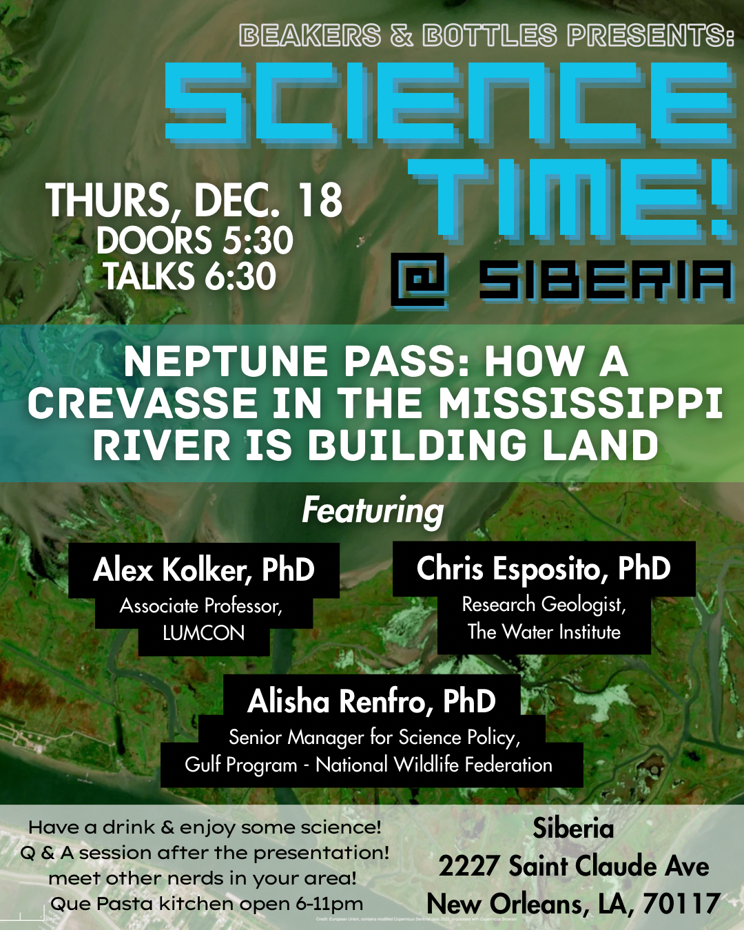
(Off-Site) Neptune Pass: How a Crevasse in the Mississippi River is Building Land
Doors 5:40 P.M., Talks Begin at 6:30 P.M.
Chris Esposito, Research Geologist at The Water Institute; Alex Kolker, Associate Professor at LUMCON; and Alisha Renfro, Senior Manager for Science Policy at Gulf Program - National Wildlife Federation
AGU25 Day 5 - Friday, December 19
OS51E-0447 Advancing Sea-Level Rise Projections in the Gulf to Inform Coastal Adaptation Strategies
8:30 A.M. Ioannis Georgiou, Director of Coastal and Deltaic Systems at The Water Institute
Relative sea-level rise in the Gulf of Mexico is projected to increase flood risks, exacerbate erosion and loss of land, and harm freshwater resources. Here we showcase our recent work that seeks to refine sea-level rise projections in the Gulf and leverage these projections to inform compound flood hazard analyses and impact assessments to support end-users in planning adaptation strategies.
Posters and Papers at AGU25
NH32A-01 Advanced Methods to Evaluate Compound Flood Risk and Forecast Flooding in Real-Time for the City of Jacksonville
Brett McMann, Client Relationship Manager
OS51E-0447 Advancing sea-level rise projections in the Gulf to inform coastal adaptation strategies
Ioannis Georgiou, Director of Coastal and Deltaic Systems
H11Q-1099 The Anatomy of a Hydrologic Extreme
Mark Bartlett, Data Science and Machine Learning Practice Lead
EP31G-1735 Cliff Erosion Observations and Modelling at the Wierum Salt Marsh in the Dutch Wadden Sea: The Importance of Local Water Levels and Site-Specific Calibration
Ioannis Georgiou, Director of Coastal and Deltaic Systems
EP13C Coastal Subsidence and Relative Sea Level Rise: Assessments, Processes, Projections, and Mitigation in Natural and Urban Environments II Poster
Christopher Esposito, Research Geoscientist
Compound Flood Hazard Modeling: A Comparative Study of CPU-Based and GPU-Accelerated Hydrodynamic Models for Emergency Response
Arslaan Khalid, Research Scientist – Flood Risk; Pranavesh Panakkal, Research Scientist – Flood Risk; Muthukumar Narayanaswamy, Director of Coastal and Compound Flood Risk
H11Q Hydrologic Extremes: Understanding Drivers, Risks, and Uncertainty I Poster
Brett McMann, Client Relationship Manager
NH11D-0390 Living Models for Reliable Real-Time Flood Situational Awareness
Pranavesh Panakkal, Research Scientist – Flood Risk; Muthukumar Narayanaswamy, Director of Coastal and Compound Flood Risk
NH41C-04 Physics-Based Models for Simulation of Compound Flood Events: Navigating Consistency, Complexity, and Computational Demands
Muthukumar Narayanaswamy, Director of Coastal and Compound Flood Risk; Arslaan Khalid, Research Scientist – Flood Risk; Pranavesh Panakkal, Research Scientist – Flood Risk; Martijn Bregman, Research Scientist - Numerical Hydraulics Luis Partida, Research Scientist - Numerical Modeling
NH43F-0497 Probabilistic Flood Risk Assessment of Road Transportation Networks Under Coastal and Compound Flooding
Pranavesh Panakkal, Research Scientist – Flood Risk; Arslaan Khalid, Research Scientist – Flood Risk; Muthukumar Narayanaswamy, Director of Coastal and Compound Flood Risk
EP21D River Deltas: Observing, Modeling, and Predicting Natural and Anthropogenic Changes I Poster
Christopher Esposito, Research Geoscientist
H34I-04 Supporting Ethical Decision Making when utilizing Artificial Intelligence and Machine Learning in Product Development for Water Management
Beaux Jones, President and CEO
H33S-1568 Using Algal Pigment Field Data to Validate Remote Sensing and Initialize Numerical Modeling for Prediction of Future Harmful Algal Blooms
Ioannis Georgiou, Director of Coastal and Deltaic Systems
EP13C-1506 Using Field-derived Elevation Milestones to Inform Synthetic, Historic DEMs for Tidal Marsh Retrospective Modeling Efforts
Christopher Esposito, Research Geoscientist
EP13C-1505 Using Remotely Sensed Inundation to Map Elevation in Low Gradient Coastal Landscapes
Christopher Esposito, Research Geoscientist