Compound Flooding
The Challenge
The impacts of flooding transcend geospatial boundaries and is the most severe of natural disasters, accounting for billions in damages every year in the United States. During 2022 Atlantic Hurricane Season, the National Oceanic and Atmospheric Administration (NOAA) reported an estimated of $56.65 billion in damages with Hurricane Ian tied for the 5th strongest U.S. landfalling hurricane (155 mph), 7th costliest (estimate >$50 billion), and deadliest Florida hurricane since 1935 Labor Day hurricane.
The risk to citizens, built, and natural infrastructure due to flooding are projected to increase in the future due to the impacts of climate change, including increasing frequency and severity of storms and changing relative sea levels. Much of flood risk reduction planning of the past has relied on a single model that accounts for either rainfall, storm surge, high tides, or other flooding factors. However, many times the causes of flooding combine one or more of these factors resulting in larger impact areas and higher damage costs than were forecast.
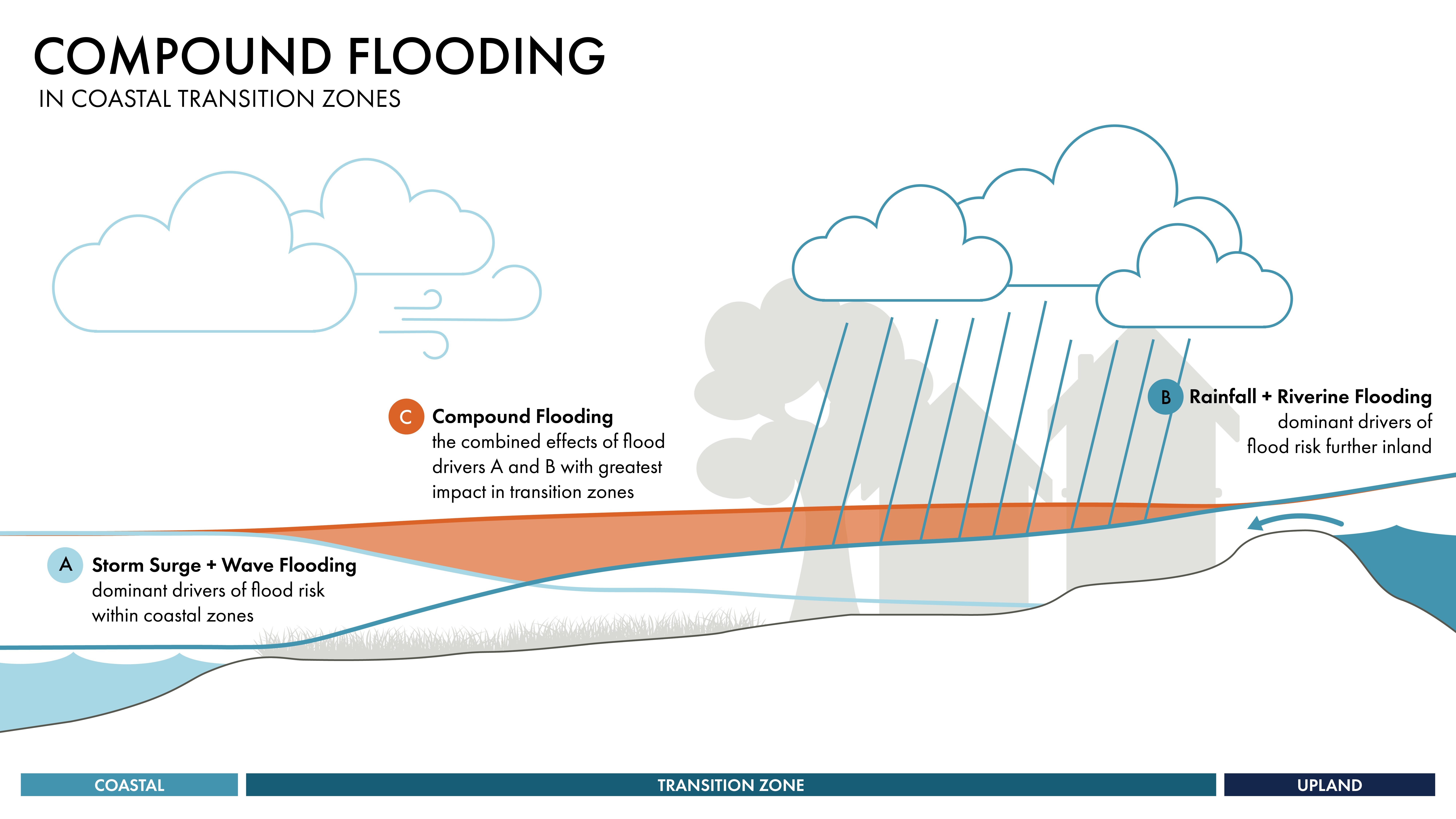
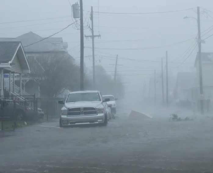
Coastal areas are exposed to various ways of flooding, including storm surge, high tides, rainfall, and elevated river flow. The occurrence of two or more of these flood mechanisms is referred to as compound flooding. Observations during numerous flood events along the Gulf of Mexico and Atlantic coastlines have demonstrated that the extents and depths of flooding due to compound flooding can be more severe than flooding due to a single flood mechanism. Consequently, the ability to understand the interplay between the various flooding mechanisms and their impact on flood depths and extents is vital for mitigation planning and design, assessment of impacts to the natural and built environment, and for pre and post disaster response.
Compound Flooding Animation video
The Approach
The Water Institute is at the forefront of quantifying the impacts of compound flooding through collaborative research tailored to advance our scientific understanding leading to the development of efficient and effective modeling approaches and associated products that can be meaningfully deployed for use by planners, emergency managers, and other decision makers.
Additionally, recognizing the critical need to better understand and quantify the impacts compound flooding, the Institute has prioritized compound flooding research with the formation of a Coastal and Compound Flood Risk department led by Muthukumar Narayanaswamy.
The team works across the Institute’s experts in applied statistics, flood modeling, software development, decision science, planning and policy, and public engagement. Additionally, the team collaborates with leading national experts at federal agencies and in academia to rapidly advance science and produce actionable, customizable, scalable tools. This combination of skills and expertise is unique to the Institute and brings the ability to analyze and translate complex model outputs into actionable and transparent solutions.
For example, in 2021, the Institute and partners were tasked by the Office of Community Development, the Governor’s Office of Homeland Security and Emergency Preparedness, and Louisiana Coastal Protection and Restoration Authority to develop a user-friendly flood forecast system – Louisiana FloodID – to provide more detailed information about compound flood potential to support related decisions during storm preparation, storm response, and in some cases storm recovery.
In another example, compound flooding is a central component of the Louisiana Watershed Initiative which examines flood risk management on a watershed basis. As part of this work, the Institute developed a first of its kind compound flood modeling approach to determine flood hazards in watersheds near New Orleans and Baton Rouge. The approach leverages state-of-the art solutions in statistics, cloud computing and automation, and flood modeling. This applied research and product development was carried out in collaboration with the University of Iowa, Purdue University, and University of Central Florida. Experts from the U.S. Army Corps of Engineers (USACE) and the Federal Emergency Management Agency (FEMA) were requested to review the work to ensure that the best available tools and methods were utilized. This partnership and associated outcomes are a clear demonstration of the Institute’s unique collaborative principles at work in developing impactful solutions to help communities. The Institute is currently in the process of deploying this compound flood modeling framework statewide to facilitate the achievement of the primary and added objectives of the Louisiana Watershed Initiative modeling efforts.
Watch the video here (or click the photo).
KEY TEAM MEMBERS