Louisiana Coastal Protection and Restoration Authority
Louisiana FloodID
Ongoing
The Challenge
Louisiana is prone to damaging floods through tropical systems, heavy rainfall, or a combination of the two, known as compound flooding. In 2021, The Water Institute and our partners were tasked by the Office of Community Development, the Governor’s Office of Homeland Security and Emergency Preparedness, and Louisiana Coastal Protection and Restoration Authority to develop a user-friendly Louisiana FloodID to support a wide range of emergency management functions and decision makers in preparation of and in response to storms.
The Approach
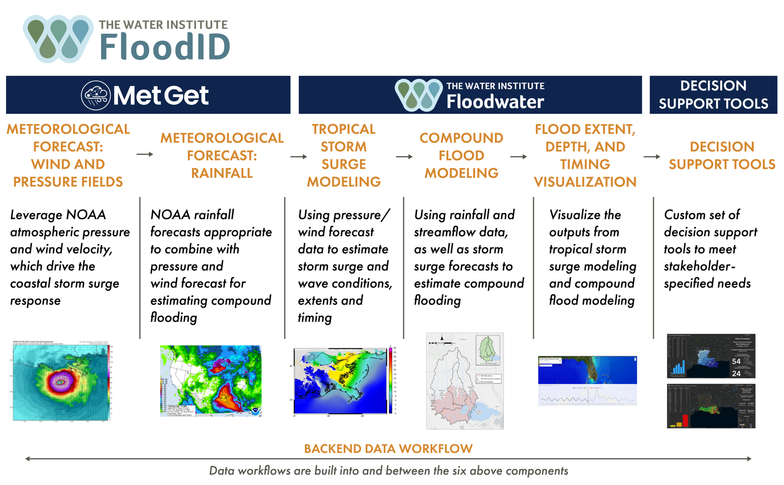
The FloodID development team leveraged several pieces of Institute-developed technology such as MetGet and the Floodwater Simulation System to create a sophisticated system that combines multiple meteorological datasets and numerical models to forecast coastal and compound flooding, as well as operational decision support tools, for pre-, during, and post-storm conditions. The decision support tools found within FloodID include dashboards for search and rescue, roadway inundation, impacts to critical response infrastructure, and damage estimates. While the FloodID system has been developed to meet Louisiana’s immediate needs, it has been designed to be extensible to support other geographies.
Watch a presentation on the work here.